August 1, 2018: I feel drawn to particular landscapes and sometimes, man-made places. When that heart-tug comes over me—whether it’s nostalgia, familiarity, or something more mysterious—I know I’m connected to the Earth and I’m alive in the moment. I treasure this feeling.
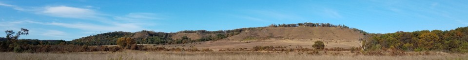
One such place that draws me is the Spring Green Preserve. So it’s no small thing that from particular vantage points (and by craning my neck), I can see this promontory from my lot. When climbed, this dry sand prairie bluff offers commanding views up and down the Wisconsin River and buzzes with unusual flora and fauna.
Another place is the Wisconsin River, just a mile away—a seemingly endless stretch of sandbars, eagles, herons, and the hush of solitude. Wild edges await at Bakkens Pond—and further west, Smith Slough & Sand Prairie. I often imagine myself back in time, when these paths were lightly trod. Who lived here, how did they make provisions, what did they see and hear?
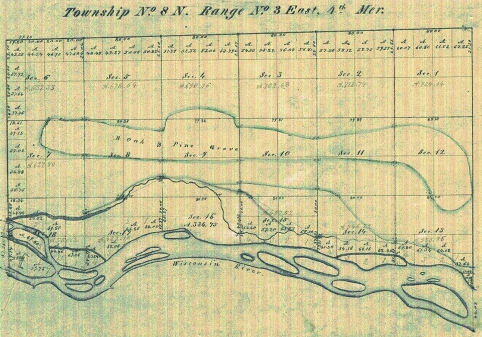
So you can imagine my delight when I found the original surveyor’s map of the region, platted in 1840 by Wm. A. Burt. He transcribed the contours of the river edge and islands big and small and edged them in blue. My lot sits in the SE ¼ of the NE ¼ of Section 12 at the edge of what was once a 6 mile stretch of a “B. Oak & Pine Grove”. Remnants of this grove can still be seen along the highway just east of Lone Rock.
Note to self: plant a Burr Oak and a White Pine.
